However a major adjustment to the jet stream pattern across the Pacific Ocean is expected to lead to even colder temperatures by next week.
The following 500 mb charts graphically illustrate the expected change.
 |
| Noon Dec 25 2014 |
 |
| Noon Dec 27 2014 |
 |
| Noon Dec 29 2014
This large high pressure ridge off the west coast will allow very cold air to pour south from Canada into the Western States including western Wyoming.
By mid day Saturday the models depict the cold air over Canada heading south toward the western States.

By noon Monday a cold polar high pressure is spreading the airmass south into the area.
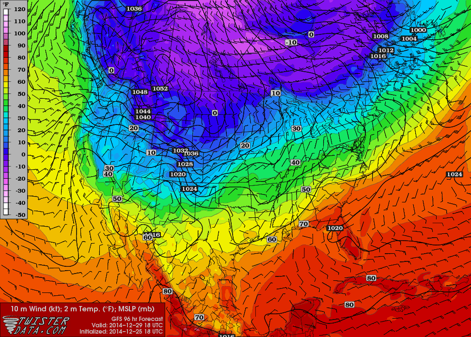 |
By Tuesday night bitter cold has engulfed all of Wyoming and surrounding states

As of now it appears that by Wednesday morning if not before the mercury will dip to 10 to 20 below zero in many areas of western Wyoming and possibly 30 below in the typically coldest locations.
No comments:
Post a Comment