Wednesday, May 31, 2017

Snow Melt Runoff on the Increase much of Western Wyoming Mountains

Hydrologic Outlook

National Weather Service Riverton WY
1055 AM MDT Wed May 31 2017

..Warm mountain temperatures Wednesday through Saturday
will accelerate snowmelt runoff...

...Flooding expected on smaller creeks and streams by the end of the
week with minor flooding along main stem rivers by the weekend...

Decreases of up to an inch of snow water equivalents (SWEs) occurred
at the 9,000 foot elevation in the last 24 hours at several SNOTEL
locations along the Green and Wind River Basin. There is still around 30
inches of SWEs at several SNOTEL locations at the 9,000 to 10,000
foot elevation across the Wind, Green, Shoshone, and Upper Yellowstone
Basins.

Afternoon temperatures at the 9,000 foot elevation are expected to
warm into the lower to middle 60s Wednesday through Saturday.
Morning low temperatures will also be above the frost
temperature of 37 degrees Wednesday through Saturday.
Windy conditions over the mountains are expected Thursday afternoon
through Friday morning. Mountain rain showers will be more widespread
Thursday afternoon through Friday morning.

Accelerated snowmelt runoff will cause sharp increases in stream and
river levels Thursday morning through Saturday morning. The greateat
increase in stream and creek levels will be Thursday evening through
Friday morning. Flooding of low lying areas is expected on smaller creeks
and streams by Friday; with minor flooding expected along main stem rivers
like the Green, Little Wind, Big Wind, Sweetwater, and Shoshone by
Saturday and Sunday.

People living near flood prone areas along creeks and rivers should make
final preparations for high water later this week through this weekend.
Mountain streams run the highest in the late afternoon through early evening
hours. Do not attempt to cross streams at that time as the swift water will
easily carry you downstream.

Look for flood watches and/or advisories to be issued Thursday and Friday
for the upcoming flooding event.
Graphical forecasts are available at:
http://water.weather.gov/ahps2/index.php?wfo=riw
Visit weather.gov/riverton and select the rivers & lakes tab for
graphical forecasts and additional information.

Saturday, May 27, 2017

Thursday, May 18, 2017

Snowfall Amounts 3pm Thursday

Public Information Statement
National Weather Service Riverton WY
310 PM MST Thu May 18 2017


...Preliminary Snowfall Amounts...

Below are snowfall amounts ending at 3 pm Thursday. Observations are
collected from a variety of sources with varying equipment and
exposures. We thank all volunteer weather observers for their
dedication. Not all data listed are considered official.

Snotel data are through 2 pm Thursday afternoon. SnoTELs (Snow
Telemetry) are remote sensing sites in high mountain watersheds.
Snowfall data from SNOTELS are estimated based on snow water
equivalent


Location                              Snowfall
Lincoln County...
 Willow Creek Snotel...              10 inches.
 Indian Creek Snotel...               7 inches.
 Spring Creek Divide Snotel...        5 inches.
 Blind Bull Summit Snotel...          5 inches.
 Star Valley Ranch...                 4 inches.
 Salt River Summit Snotel...          4 inches.
 Kelley Ranger Station Snotel...      4 inches.
 Cottonwood Creek Snotel...           3 inches.
 2 SE Thayne...                     2.5 inches.
 3 SE Bedford...                      2 inches.
 Hams Fork Snotel...                  2 inches.
 5 SSE Smoot...                       1 inch.
 3 N Etna...                          1 inch.
 Afton...                           0.5 inches.
Big Horn County... Bald Mountain Snotel... 6 inches. Shell Creek Snotel... 2 inches. Bone Springs Divide Snotel... 1 inch. Fremont County... South Pass Snotel... 14 inches. Cold Springs Snotel... 14 inches. Deer Park Snotel... 13 inches. Hobbs Park Snotel... 12 inches. Townsend Creek Snotel... 12 inches. St. Lawrence Alt Snotel... 9 inches. Little Warm Snotel... 5 inches. Burroughs Creek Snotel... 4 inches. Jeffrey City... 3 inches. 6 SW Lander... 2.4 inches. 9 S Lander... 2.2 inches. Lander... 1 to 2.2 inches. Dubois... 2 inches. Lander... 1.9 inches. Atlantic City... 1.7 inches. Riverton... 1 inch. 2 W Riverton... 0.3 inches. 4 W Riverton... 0.3 inches. Hot Springs County... Owl Creek Snotel... 4 inches. Johnson County... Cloud Peak Reservoir Snotel... 11 inches. Soldier Park Snotel... 9 inches. Little Goose Snotel... 7 inches. Bear Trap Meadow Snotel... 1 inch. Natrona County... Casper Mountain Snotel... 8 inches. Reno Hill Snotel... 6 inches. Grave Spring Snotel... 4 inches. Powder River... 2 inches. 5 SSW Casper... 0.8 inches. Park County... Marquette Snotel... 14 inches. Pahaska... 14 inches. Evening Star Snotel... 13 inches. Beartooth Lake Snotel... 13 inches. Blackwater Snotel... 11 inches. Timber Creek Snotel... 11 inches. Kirwin Snotel... 8 inches. Wolverine Snotel... 5 inches. Younts Peak Snotel... 4 inches. 26 SW Cody... 3.5 inches. 1 ENE Wapiti... 3 inches. 3 NE Sunshine... 1.6 inches. Sublette County... Elkhart Park G.S. Snotel... 7 inches. Gunsite Pass Snotel... 7 inches. Loomis Park Snotel... 6 inches. Triple Peak Snotel... 6 inches. Big Sandy Opening Snotel... 4 inches. New Fork Lake Snotel... 2 inches. Larsen Creek Snotel... 2 inches. East Rim Divide Snotel... 2 inches. Snider Basin Snotel... 2 inches. Pinedale... 1 inch. 14 NW Pinedale... 0.5 inches. Sweetwater County... 4 NNW Rock Springs... 0.1 inches. Teton County... Grassy Lake Snotel... 9 inches. Togwotee Pass Snotel... 9 inches. Base Camp Snotel... 6 inches. Phillips Bench Snotel... 3 inches. Jackson Dam... 2.6 inches. 1 NNW Alta... 1 inch. 12 NE Jackson... 1 inch. Moose... 0.5 inches. 5 NW Jackson... 0.4 inches. Washakie County... Middle Powder Snotel... 3 inches. Powder River Pass Snotel... 3 inches. Yellowstone National Park... Parker Peak Snotel... 13 inches. Sylvan Lake Snotel... 11 inches. Canyon Snotel... 10 inches. Lewis Lake Divide Snotel... 6 inches. Thumb Divide Snotel... 5 inches. Mammoth... 2.1 inches. Sylvan Road Snotel... 1 inch. Snake River Ranger Station... 1 inch. Yellowstone East Entrance... 1 inch. Tower Falls Ranger Station... 1 inch.

Wednesday, May 17, 2017

Star Valley Skies in mid May

Not your typical May sky over Star Valley. View from west hill across Afton on Wednesday.

Forecast for Star Valley as of 8AM Wednesday-Hard Drive Issues affect the Web Site for a Couple Days

With the loss of a hard drive the Star Valley Weather Forecast and radar and satellite data is not available on the web site.  This will take a couple days to fix.  Periodically will post the latest forecast on the blog.  As of 8am Wednesday the forecast is as follows:

Today
Snow showers before 11am, then rain and snow showers likely between 11am and 1pm, then scattered rain showers after 1pm. High near 42. West southwest wind around 7 mph. Chance of precipitation is 90%. Total daytime snow accumulation of 1 to 2 inches possible.
Tonight
Scattered rain showers before 9pm, then scattered snow showers. Mostly cloudy, with a low around 26. West wind around 5 mph becoming calm in the evening. Chance of precipitation is 40%. New snow accumulation of less than a half inch possible.
Thursday
A slight chance of rain and snow showers before noon, then a slight chance of snow showers. Mostly cloudy, with a high near 50. Calm wind becoming north 5 to 8 mph in the afternoon. Chance of precipitation is 20%.
Thursday Night
A 20 percent chance of showers before midnight. Partly cloudy, with a low around 32. North northwest wind 5 to 7 mph becoming calm in the evening.
Friday
Mostly sunny, with a high near 57. Calm wind becoming northwest 5 to 7 mph in the afternoon.
Friday Night
Partly cloudy, with a low around 32. Northwest wind around 6 mph becoming calm in the evening.
Saturday
A 20 percent chance of showers and thunderstorms after noon. Mostly sunny, with a high near 61. Light and variable wind.
Saturday Night
A 20 percent chance of showers and thunderstorms before midnight. Mostly cloudy, with a low around 34.
Sunday
A 40 percent chance of showers and thunderstorms after noon. Partly sunny, with a high near 65.
Sunday Night
A chance of rain showers before midnight, then a slight chance of rain and snow showers. Some thunder is also possible. Mostly cloudy, with a low around 34. Chance of precipitation is 40%.
Monday
A slight chance of showers and thunderstorms. Partly sunny, with a high near 65.
Monday Night
A slight chance of showers and thunderstorms. Mostly cloudy, with a low around 34.
Tuesday
Mostly sunny, with a high near 66.

Tuesday, May 16, 2017

Snow Returns to Western Wyoming


Salt River and Wyoming Ranges-
1005 PM MDT Tue May 16 2017

...WINTER WEATHER ADVISORY IN EFFECT UNTIL 6 PM MDT WEDNESDAY...

The National Weather Service in Riverton has issued a Winter
Weather Advisory for Snow, which is in effect until 6 PM MDT
Wednesday.

* TIMING...Moderate to occasionally heavy snowfall will increase
  across much of the Salt and Wyoming Mountains later tonight...
  continuing through Wednesday.

* TOTAL SNOW...4 to 12 inches.

* MAIN IMPACT...Highways may become slick, slushy and snow
  covered, including the Salt River Pass. Visibility could be
  reduced to under one quarter mile at times in heavy snow.

PRECAUTIONARY/PREPAREDNESS ACTIONS...

A winter weather advisory for snow means periods of snow will
cause primarily travel difficulties. Be prepared for snow covered
and slick roads with limited visibilities. Slow down, and allow
extra time to reach your destination. Check the latest road
conditions at wyoroad.info or by dialing 5 1 1.

Model Snow Forecast through Thursday Morning

WINTER WEATHER ADVISORY REMAINS IN EFFECT FROM 6 PM THIS EVENING TO 6 PM MDT WEDNESDAY

URGENT - WINTER WEATHER MESSAGE
National Weather Service Pocatello ID
312 AM MDT Tue May 16 2017

Upper Snake Highlands-South Central Highlands-Caribou Highlands-
Wasatch Mountains/Idaho Portion-
Including the cities of St. Anthony, Ashton, Island Park, Driggs,
Victor, Malad City, Oakley, Rockland, Henry, Soda Springs,
Downey, Lava Hot Springs, and Montpelier
312 AM MDT Tue May 16 2017

...WINTER WEATHER ADVISORY REMAINS IN EFFECT FROM 6 PM THIS
EVENING TO 6 PM MDT WEDNESDAY...

* IMPACTS...Accumulating snow may create difficult travel
  conditions especially over mountain passes. Backcountry travel
  and recreation may become dangerous.

* TIMING...Accumulating snow will begin this evening and continue
  through Wednesday, becoming heavy at times late tonight.

* SNOW ACCUMULATIONS...Storm total through Wednesday afternoon
  of 5 to 10 inches above 6000 feet and 1 to 4 inches in the
  mountain valleys.

* CONFIDENCE...High confidence in timing. Low confidence in
  accumulations due to dramatically fluctuating snow levels.

* LOCATIONS...Elevations primarily above 6000 feet, including
  Pine Creek Pass, Fish Creek Summit, Georgetown Summit, and the
  Island Park area.

Monday, May 15, 2017

Update on Star Valley Stream Flooding Monday Morning

Flood Advisory
National Weather Service Riverton WY
910 AM MDT MON MAY 15 2017

910 AM MDT MON MAY 15 2017

The National Weather Service in Riverton has extended the

* Small Stream Flood Advisory for...
  Snowmelt in...
  West central Lincoln County in west central Wyoming...

* Until 830 AM MDT Wednesday

* At 856 AM MDT emergency management reported widespread minor
  agricultural flooding is still occurring in many locations in Star
  Valley.  Still no structures or homes are in danger of flooding at
  this time. Secondary roads continue to have minor flooding along
  low lying areas.

* Crow Creek near Fairview continued to slowly recede Sunday
  afternoon through early Monday morning. The Salt River continues
  to very slowly recede and is forecasted recede below flood stage
  of 5.5 feet by early Wednesday morning. Low land flooding along
  Swift Creek in northeastern and northern sections of Etna will
  continue with the current and expected river levels of the Salt
  River.

* Rain is expected over the Salt River Basin on Tuesday afternoon
  and evening followed by mostly all snow by early Wednesday.
  Rainfall totals are forecasted to be less than half an inch.

PRECAUTIONARY/PREPAREDNESS ACTIONS...

Please report flooding to your local law enforcement agency when you
can do so safely.

Thursday, May 11, 2017

Stream Flood Advisory until Saturday Evening

Salt River in Narrows Thursday Afternoon


Flood Advisory
National Weather Service Riverton WY
838 PM MDT THU MAY 11 2017

Lincoln-
838 PM MDT THU MAY 11 2017

...THE SMALL STREAM FLOOD ADVISORY FOR SNOWMELT REMAINS IN EFFECT
UNTIL 830 PM MDT SATURDAY FOR WEST CENTRAL LINCOLN COUNTY...

* Small Stream Flood Advisory for... Snowmelt in... West central
  Lincoln County in west central Wyoming...

* Until 830 PM MDT Saturday

* At 830 pM MDT, widespread minor flooding continues near the towns
  of Fairview and Freedom. No structures or homes are in danger of
  flooding at this time. Secondary roads continue to have minor
  flooding along low lying areas.

* Crow Creek near Fairview continues to slowly recede. Emergency
  management reports the Spring Creek and other smaller creeks
  downstream of Fairview are running very high. The Salt River near
  Etna continues to rise slowly and continues just above the flood
  stage of 5.5 feet.  The river is expected to continue to rise
  slowly over the next 2 days. Low land flooding along Swift Creek
  in northeastern and northern sections of Etna will continue with
  the current and expected river levels of the Salt River.

* Increased snowmelt runoff will increase during the next several
  days in response to warming basin temperatures today and Friday.
  Expect further rises along Crow Creek and along the Salt River
  into the weekend.

PRECAUTIONARY/PREPAREDNESS ACTIONS...

Please report flooding to your local law enforcement agency when you
can do so safely.


Thursday Morning Update on Salt River Flooding Situation


Advisory
National Weather Service Riverton WY
825 AM MDT THU MAY 11 2017

Lincoln-
825 AM MDT THU MAY 11 2017

The National Weather Service in Riverton has extended the

* Small Stream Flood Advisory for...
  Snowmelt in...
  West central Lincoln County in west central Wyoming...

* Until 830 PM MDT Saturday

* At 756 AM MDT, emergency management reported widespread minor
  flooding continues near the towns of Fairview and Freedom. No
  structures or homes are in danger of flooding at this time.
  Secondary roads continue to have minor flooding along low lying
  areas.

* Crow Creek near Fairview continues to slowly recede. Emergency
  management reports the Spring Creek and other smaller creeks
  downstream of Fairview are running very high. The Salt River near
  Etna continues to rise slowly and is currently just above the
  flood stage of 5.5 feet.  The river is expected to continue to
  rise slowly in the next 2 days. Low land flooding along Swift
  Creek in northeastern and northern sections of Etna will continue
  with the current and expected river levels of the Salt River.

* Increased snowmelt runoff will increase during the next several
  days in response to warming basin temperatures on Thursday and
  Friday. Expect further rises along Crow Creek and along the Salt
  River into the weekend.

PRECAUTIONARY/PREPAREDNESS ACTIONS...

Please report flooding to your local law enforcement agency when you
can do so safely.


Wednesday, May 10, 2017

Salt River Above Flood Stage and Could Approach Record Levels By This Weekend

Flood Advisory
National Weather Service Riverton WY
939 AM MDT WED MAY 10 2017


939 AM MDT WED MAY 10 2017

...THE SMALL STREAM FLOOD ADVISORY FOR SNOWMELT REMAINS IN EFFECT
UNTIL 830 AM MDT THURSDAY FOR WEST CENTRAL LINCOLN COUNTY...

At 921 AM MDT, emergency management reported minor flooding has
become widespread near the towns of Fairview and Freedom. Secondary
roads continued to have minor flooding along low lying areas.

Crow Creek near Fairview crested Tuesday afternoon and has slowly
receded Wednesday morning. The Salt River River near Etna continues
to rise slowly and is currently just above the flood stage of 5.5
feet.  The river is expected to continue to rise slowly in the next
2 days. Low land flooding along Swift Creek in northeastern and
northern sections of Etna will continue with the current and
expected river levels of the Salt River.

Warmer basin temperatures by the end of the week will increase
snowmelt runoff.  Expect further rises in Crow Creek and the Salt
River through the later part of the week into the weekend.

The Salt River Gauge near Etna Wednesday Evening of 5.58 feet is above flood stage 
and could approach the record level of  6 feet by this weekend.

Tuesday, May 9, 2017

Flood Advisory Crow Creek and Salt River

Flood Advisory
National Weather Service Riverton WY
846 AM MDT TUE MAY 9 2017

Lincoln-
846 AM MDT TUE MAY 9 2017

The National Weather Service in Riverton has issued a

* Small Stream Flood Advisory for...
  Snowmelt in...
  West central Lincoln County in west central Wyoming...

* Until 830 AM MDT Thursday

* At 825 AM MDT, Crow Creek near Fairview continues to rise in
  response to excess snowmelt runoff. The creek is expected to crest
  late tonight into early Wednesday morning.

* Expect minor flooding of ranchland and pastureland near the towns
  of Freedom, Fairview, and Etna. Minor flooding can also be
  expected along low lying areas of secondary roads near Freedom,
  Fairview, and Etna.

* The Salt River near Etna is forecasted to rise to near the flood
  stage of 5.5 feet by early Wednesday morning.  Expecte minor low
  land flooding along Swift Creek in northeastern and northern
  sections of Etna. The Salt River is expected continue to slowly
  rise through Thursday.


PRECAUTIONARY/PREPAREDNESS ACTIONS...

Monday, May 8, 2017

Water Supply Outlook for Wyoming May 8 2017

…Wyoming April 2017 precipitation was 150 to 160 percent of average...
...Current water year precipitation is averaging 140 to 150 percent of normal across Wyoming…
…Mountain snowpack across Wyoming is 125 to 135 percent of median... 
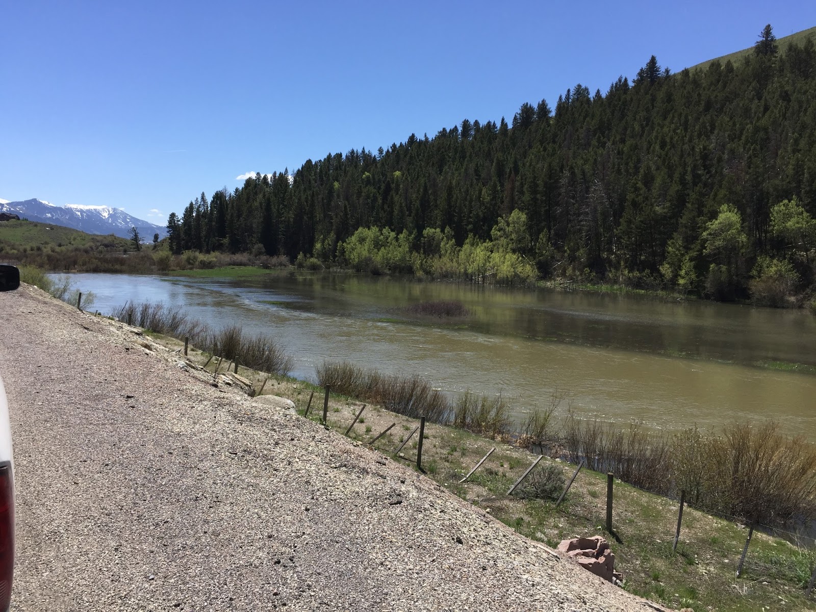
Above to much above normal snowmelt streamflow volumes are still expected across 
most major basins in Wyoming…
…Wyoming reservoir storages are 125 to 135 percent of average for May… 

SYNOPSIS

April precipitation totals across Wyoming were 150 to 160 percent of average. 
Precipitation numbers varied between near 250 percent of normal over the 
Tongue River Drainage (north central Wyoming) to near 110 percent of normal 
over the Lower Green Basin (southwestern Wyoming).  Current water year
 (October 2016 – April 2017) precipitation across Wyoming is averaging 
140 to 150 percent of average.
 
Mountain snowpack across Wyoming was 125 to 135 percent of median by early May.
Snowpack "water" numbers and/or SWEs were the highest across basins in central
Wyoming (Wind, Upper Green, and Sweetwater)—varying between 
190 to near 230 percent of median.  SWEs across basins in southeastern 
Wyoming were 85 to near 100 percent of median.  
 
Above to much above normal (160 to near 175 percent) snowmelt streamflow 
volumes continue to be expected across almost all major basins across Wyoming. 
Well above average (180 to 250%) snowmelt streamflow volumes are still expected 
across the Snake, Wind, Sweetwater, Shoshone, and Upper Green Watersheds.
The Little Snake, Upper North Platte, and Laramie Basins are forecasted to have slightly below to 
slightly above normal streamflow volumes during the upcoming snowmelt season. 
 
Reservoirs storages across Wyoming remained above average at 125 to 135 percent for May.


Sunday, May 7, 2017

Hail and Lightning just west of Star Valley Ranch

A Hailstorm occurred this Sunday afternoon around 1:30. It was very localized vicinity Prater Canyon Road and US-89.  Hail was no larger than 3/8 of an inch in diameter.


There also was considerable cloud to ground lightning.  The Cam at Star Valley Ranch which looks toward Caribou peak caught one of these strikes.


Thursday, May 4, 2017

Snowmelt Runoff into Small Streams and Creeks will Drastically Increase Over The Weekend

Hydrologic Outlook
National Weather Service Riverton WY
1233 PM MDT Thu May 4 2017

...Warm basin temperatures across Western and Central Wyoming
through Saturday will cause steady rises in small creeks and
streams Friday afternoon through Sunday afternoon...

...Rain expected across Western and Central Wyoming Tuesday
through Thursday of next week will increase flood potential...

Snowmelt runoff into small streams and creeks will drastically
increase due to warm basin temperatures across Western and
Central Wyoming through Saturday. Small streams and creeks will
see steady rises Friday afternoon through Sunday afternoon with
the increased snowmelt runoff.

Afternoon temperatures at the 9000 foot elevation are forecasted
to be into the lower 60s Friday and Saturday with overnight lows
Friday night staying between 35 and 40. Temperatures are expected
to cool down into the lower to middle 50s by Sunday afternoon.

After the warm temperatures, the next main concern will be how
much rain may fall across the area in the early to middle part of
next week. A large upper level low pressure system is expected to
develop over the Desert Southwest Sunday into Monday before
gradually moving east to northeast into Colorado Wednesday or
Thursday of next week. Some lighter amounts of rain in the form of
showers and isolated thunderstorms will fall in spots late in the
weekend into early next week but the most significant rain
potential will likely hold off until later Tuesday night through
Thursday. How much rain falls during this period is the bigger
question. The computer models are differing on timing by up to a
day and by quite a bit on total rainfall. The potential for a
couple inches of rain do exist in the foothills of Central and
Southwest Wyoming with with less in the northwest mountains. The
lower elevations of the same area could see up to an inch of rain
but these are just very preliminary indications. Lesser amounts of
rain are possible late Sunday through Monday before the more
significant rain potential begins. The bottom line is that
significant rainfall could fall on the snowpack in the early to
middle part of next week. Snow levels will be quite high and
mostly in the 9000 feet and above level with some lowering
Wednesday into Thursday.

Tributary creeks and streams may reach bankfull by Sunday morning
through Monday morning due to excess snowmelt runoff and rainfall
runoff. Minor flooding of low lying areas is possible due to the
elevated stream levels. Main stem rivers will see noticeable rises
by Sunday morning with continued rises possible on Monday. Main
stem rivers are expected to remain below flood levels through
Monday.

The forecasted rain Tuesday through Thursday will increase flood
potential across Western and Central Wyoming. Stay tuned for
updated outlooks, advisories, and warnings as we get closer to
this developing rain on snowmelt event.