Tuesday, November 29, 2011

December will Begin Cold in Star Valley

A storm which can be seen with the water vapor imagery this evening over Vancouver Island  will be the big weather maker  over the interior west the next several days.
Water Vapor Imagery Tuesday evening 11/29/11


By Thursday morning this low is forecast to drop southward to the west of Wyoming into the desert Southwest.  The computer models  have been  consistently forecasting this scenario for the past several days.

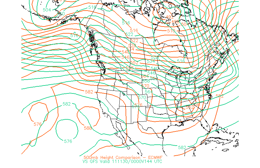
500 mb Forecast Thursday morning 12/1/11 
Much colder air will then flow southward from Canada into Wyoming by Thursday in the strong north/northeast flow as the upper low heads toward Arizona.

This type of pattern with much of the upper low energy tracking west of Star Valley should limit the snow potential.  At this time a couple inches are probably all that can be expected to fall over the valley by Wednesday night. While strong northerly winds will spread across Wyoming and down the upper Snake River Valley by Thursday morning, Star Valley will  be protected by the Salt Range limiting both the wind and wind chill effect in contrast to other areas of Wyoming.An exception could be in the Alpine area where the Snake River Canyon will likely channel the stronger east winds.

As cold air pours southward Thursday, afternoon temperatures will struggle to reach 20 and by evening rapidly fall to near/below zero.  With skies clearing by Thursday night  below zero will be common with coldest Star Valley locations such as Auburn and Thayne could drop to 10-15 below.

While any additional snow other than flurries is unlikely, cold high pressure will dominate into next week.

The Riverton WFO has provided an excellent presentation how the incoming storm will effect Wyoming.  This can be seen at:


http://www.crh.noaa.gov/news/display_cmsstory.php?wfo=riw&storyid=75650&source=0

Monday, November 28, 2011

Star Valley Ranch Weather Station Now Corrected

The temperature at the Star Valley Ranch weather station which had been running about 12 degrees too cold since 11/23 is now displaying the correct reading.

Sunday, November 27, 2011

Other Than Wednesday, a Quiet Weather Week is in the Offing

Clouds began returning to the skies of Star Valley late Sunday afternoon.  Overall it was a cool but very sunny weekend.  Clouds are the forerunners of a rather weak disturbance which will be crossing mainly north of Star Valley tonight and Monday morning.  While there is the possibility of a few snow flurries  toward morning, the main effect of the clouds will be to provide an insulating blanket and keep overnight temperatures well above zero.

High pressure takes over again by Monday night leading to a very pleasant and generally sunny Tuesday.  The next storm of interest is expected to be much stronger and approach the Pacific Northwest states Tuesday from the Gulf of Alaska.  The following sequence of forecasted 500 mb Charts show the expected evolution of this system during the week.

Tuesday Evening
Wednesday Evening


Thursday Evening


If this model scenario verifies, which seems likely as several models are in close  agreement, then Wednesday will be the stormy day of  the coming workweek.  Colder but generally fair weather returns as high pressure moves in and the developing upper low that effects Star Valley on Wednesday settles southward into the desert Southwest. It  is still too early to determine the snow potential for Wednesday.

Friday, November 25, 2011

Very Strong Winds Friday, However Quiet Weather Ahead

As expected a fast moving trough of low pressure intensified as it crossed Western Wyoming Friday afternoon, producing some very strong winds and briefly near blizzard conditions.  Here is a list of strongest reported gusts Friday:

Mt. Coffin                   108 mph  (10,800 ft)
Jackson Hole Summit    72 mph  (10,300 ft)
Alpine                           51 mph
Star Valley Ranch          50 mph
Thayne                          42 mph

This evenings 300 mb analysis(30,000 ft) clearing shows the strongest jet stream crossing the area from the northwest where winds were in excess of 130 mph at its core.

300 mb (30,000 ft) Friday Evening Nov. 25 2011


While actual new snow in the valley was generally less than 2 inches, the strong winds produced briefly near blizzard conditions.

Rapid clearing has occurred this evening as high pressure spreads across the area. As the winds diminish temperatures are falling.  As of 9pm Thayne ES had already dipped to 7 above and by sunrise the coldest  Star Valley locations likely will be at least a couple degrees below zero.


High pressure will dominate for the next several days with the next threat of any significant precipitation not expected until at least next Wednesday, if then.   Here is a model depiction of the precipitation that is forecasted through next Tuesday.

GFS Model Forecasted Precipitation from Saturday until Tuesday.


Today's storm in Wyoming will become a big precipitation producer in the eastern U.S.  Heavy storms will continue to hammer the Pacific Northwest coast northward into Canada.  High pressure will protect our part of the country from any storm activity.

Thursday, November 24, 2011

Fast Moving Storm Friday, Followed By Several Dry Days.

Under mostly clear skies a strong inversion developed overnight across Star Valley.  Dramatic differences in temperatures were observed this morning.  Etna ES dipped to 13 and Afton 12.  However, in places like the forested areas of Star Valley Ranch and Salt River Summit, above the inversion,  low temperatures this morning were as much as 20 degrees warmer, barely dipping below freezing.

Warmer air has spread across Star Valley above the inversion on Thanksgiving Day.  Surface temperatures have risen into the 40s above the valley floor such as at Star Valley Ranch, even as clouds thicken ahead of the next Pacific storm. However, as of early afternoon Etna ES, below the inversion, has yet to reach freezing.   The next system currently in the Pacific Northwest will move rapidly eastward bringing  at least some snow across southeastern Idaho and western Wyoming beginning after midnight.  There could be brief moderate snow as the cold front crosses the area late tonight and Friday morning. The speed of  the system is expected to limit accumulations to no more than a couple inches in the Valley and somewhat greater amounts in the mountains, particularly the Tetons.

Rapid improvement  will occur by Friday afternoon as high pressure takes over.  This will lead to a dry weekend continuing into the middle of the coming work week.  The storm track shifts well to the north  assuring a quiet end to what has been a stormy November.

Comparison of GFS and ECMWF 500 mb Tuesday afternoon 11/29/11
While there are considerable differences in the model solutions Tuesday, both keep the storm track to the north of the Valley.  However, by late Wednesday/Thursday the ECMWF(European Model) suggests a return to stormy conditions while the GFS(Globel Model) keep the Valley high and dry.

Comparison of GFS and ECMWF 500 mb Wednesday afternoon 11/30/11

Wednesday, November 23, 2011

Star Valley Ranch Weather Station

The Star Valley Weather Station is running about 10 degrees too cold.  This will be corrected as soon as possible, but may not be until Monday as the Console is located in the Public Works building.

Tuesday, November 22, 2011

Pattern Change Leading to Drier end of November

Star Valley/Western Wyoming for the first three weeks of  November has been colder and wetter than  normal.  Over 3 feet of snow has fallen at Star Valley Ranch with a similar amount near Smoot  at the upper end of the valley.  The Numerical forecast  models are in agreement that the storm track which has been through this part of the country will be shifting back to the north the rest of the month. With the exception of a fast moving low pressure system that will move through late Thanksgiving day and Friday, it now appears that high pressure will be in control for the remainder of November.

Wednesday and Thanksgiving day will finally see temperatures rise to near or above normal. Afternoon highs will be warming to  40  or higher with more sunshine than in the past few days.  Friday will see a temporary return to cloudy with precipitation, likely in the form of snow.  At this time it appears that several inches are likely in the nearby mountains, but valley totals should be no more than a couple inches.

500 mb Forecast Friday afternoon Nov. 25 2011


High pressure quickly takes control over the weekend with the likelihood of mostly sunny and dry days.  With the clearing skies overnight temperatures will drop to single digits in the coldest valley locations.  Valley temperatures will be slow to warm given the low sun angle this time of year, with warmer temperatures in the higher elevations such as nearby ski areas.

500 mb Forecast Saturday Evening Nov. 26, 2011


With the jet stream and storm track well to the north early next week, fair conditions should dominate.  This time of year the substantial snow cover, under high pressure, will result in favorable conditions for overnight fog formation.  This could temper the amount of warming in the valleys, particularly if the fog fails to burn off in the afternoon.

Saturday, November 19, 2011

Storm Exits Star Valley-Thanksgiving Outlook Looks Good

The latest storm has cleared Star Valley but a cold and unstable air mass remains. Mostly light  snow showers will continue until this evening.  New snow across the valley ranged from 6-8 inches with 8 inches at Star Valley Ranch. Here is a map of the Snowfall totals for the storm produced by Riverton WFO.

Total Snowfall Nov. 17-19 2011


The current 500 MB analysis  shows the strong polar jet stream heading on to the east into the plains with a new jet approaching California
500 MB Analysis Saturday Morning 11/19/11


The greatest snowfall with this storm occurred over the mountains with  between one and two feet falling in the Tetons and about a foot over the Salt Range.

As we move toward Thanksgiving Day the storm track is forecast to shift to the south  of Star Valley with the next system now approaching the California coast .

500 MB Forecast Tuesday Morning 11/22/11
This system is weaker than the previous system that just moved across the area.  Much of the precipitation will pass well south of Star Valley as this trough of low pressure moves east into the Central Plains by Tuesday.

While another trough of low pressure will be moving onshore along the west coast by Thanksgiving day, the primary area of precipitation should again remain south and west of the valley.  Southwesterly flow across southeast Idaho/western Wyoming is likely to be rather mild but result in quite a bit of cloud cover along with chance of either rain or snow showers.


500 MB Forecast Thursday Morning 11/24/11


It now appears that any precipitation will have minimal impact on Thanksgiving travel in Southeast Idaho/Western Wyoming.

The graphic below is the forecast  of total precipitation for the 4-day period Monday to Thursday this coming week. It should be a wet period for much of the west coast, but only scattered light amounts over the interior west.


Total Forecasted Precipitation 5AM Mon -5AM Thu

Thursday, November 17, 2011

UPDATE ON THE POTENTIALLY HEAVY SNOWFALL IN STAR VALLEY

The major storm system is still on track to move eastward across southern Idaho into Western Wyoming. Light snow is beginning this morning in parts of the valley and will continue and increase during the day. It now appears that the potential for heavy snow with accumulations of 6-8 inches or more could occur in the valley before diminishing Friday night when the colder air arrives. The nearby mountain ranges will likely receive well over a foot. Even greater amounts of snow, possibly upwards of 2 feet by Saturday morning will fall over the Teton Range and southwestern portions of Yellowstone National Park.

Given the nearly 2 day duration of snow the total depth is expected, as mentioned, to be substantial. Temperatures will remain near freezing in the valley until the strong cold front arrives later on Friday. With the front will come gusty winds and temperatures falling into the teens, with deteriorating driving conditions in the valley and all roads out of the area.

The weekend still appears to be cold, however significant snowfall should be over.

Tuesday, November 15, 2011

MORE SNOW ON THE WAY FOLLOWED BY A VERY COLD WEEKEND

Wednesday will be another fairly quiet day weatherwise across Star Valley with still a chance of snow flurries similar to Tuesday.  Big changes will be underway by early Thursday. A disturbance will be moving across the Pacific Northwest Wednesday and spread increasing precipitation across Star Valley beginning by Thursday morning. The 300 MB forecasted  winds for Thursday morning show the strong jet stream heading toward Idaho and Western Wyoming.

300 MB FORECAST THURSDAY MORNING 11/17/2011


Temperatures with this  system will remain near freezing in the valley, favorable for a rather wet snow. There could be several inches fall in the valley by Thursday night/Friday morning and higher amounts in the nearby mountains. 

300 MB FORECAST FRIDAY EVENING 11/18/2011
On Friday a very cold upper level trough of low pressure moves eastward from the Pacific Northwest states, which not only will continue periods of snow, possibly heavy in the mountains, but spread the coldest air yet this Fall across Star Valley.  The coldest air will arrive Friday night and by Saturday temperatures will remain in the low to mid 20s in the valley throughout the day.

300 MB FORECAST SATURDAY EVENING 11/19/2011    
By Saturday evening the strong jet stream and upper system will have moved rapidly on to the east of western Wyoming, leaving Star Valley under a very cold air mass which will end any significant snow threat.  Dependent on the amount of clearing that occurs, below zero temperatures are possible Sunday morning, at least in the typically coldest valley locations nearer the Salt River such as Auburn, Thayne and Etna.

Looking ahead to the first of the coming work week, it looks like high pressure will dominate with still cold nighttime temperatures, possibly below zero, and a slow climb in afternoon readings.  However there is potential for fog forming in the valley which would limit the heating potential in the afternoon.

Monday, November 14, 2011

CLIMATE

The Climate link on Starvalleyweather.com is to the data from the official climatological station located just southeast of Bedford WY.  The record for this site goes back to 1975 with very few missed observations. At this time just the current month data will be available from Starvalleyweather.com but plans are to eventually make the site more robust. The link to the official station data can be found at

http://www.wrcc.dri.edu/cgi-bin/cliMAIN.pl?wy0603

Sunday, November 13, 2011

A VERY SNOWY WEEKEND IN STAR VALLEY

Snowfall Totals in inches Nov 12-13 2011
As shown on this graphic from WFO Riverton large amounts of snow fell across all of Star Valley from early Saturday morning until Sunday afternoon.  The greatest total observed was 19 inches at Star Valley Ranch followed by the 15 inches at the weather station just south of Smoot, 14 inches in Thayne and 12 inches in Alpine.

The snowfall resulted from two fast moving systems  across Western Wyoming.The first included considerable wind at higher elevations Saturday morning.  There was temporary afternoon clearing as seen from this photo in Star Valley Ranch.

At the same location on the Ranch this picture was taken Sunday morning  where an additional 10 inches had fallen overnight!

  The pattern that has resulted in this sudden change over the weekend is still in place as can be seen on this evenings water vapor imagery.

Water Vapor Image Sunday Evening  Nov 13 2011

A broad area of moisture extends from the  Gulf of Alaska southeastward across the Pacific Northwest and pointed toward western Wyoming.  What this implies is that while the snow has generally stopped across Star Valley Sunday evening, additional fast moving but somewhat weaker upper disturbances while continue the potential for periods of generally light snow into Tuesday.  Another 1 or 2 inches is possible but it appears that another bout of heavy snow seems unlikely.

By Wednesday high pressure will temporarily diminish or end any snowfall threat. It does appear that a major change in the large scale weather pattern will take place by the end of the work week increasing the potential for another significant storm affecting Star Valley/western Wyoming.

500 MB Forecast Saturday Nov. 19 2011
This is a model forecast depicting the development of a large scale upper level low pressure trough across much of the Western States.  Since it is still 5-6 days away, the reliability of these forecasts are somewhat limited but there is sufficient confidence to expect  the threat of winter weather conditions across much of the area from the Rockies westward including Star Valley.

Thursday, November 10, 2011

Big Changes this Weekend Continuing into Next Week

500 MB Noon Saturday 11/12/2011
After one more day on Friday of cool but pleasant weather, a fast moving storm will sweep across Star Valley Saturday morning.  This system is a spin off from the massive storm that slammed Western Alaska Wednesday.  It was one of most powerful storms in that part of Alaska in the past 40 years.  The system which will move from the Gulf of Alaska southeastward into the Pacific Northwest early Friday will bring a strong cold front across the southeastern Idaho/western Wyoming area Saturday morning.

Snow levels will quickly drop to the valley floor  Saturday morning with heavy snow for a couple hours with and just behind the front.  The strong westerly flow will lead to the greatest snowfall along the north-south mountain ranges including the Salt  and Tetons.  Snowfall amounts will be greatest north of the Snake River with 4-8 inches in the mountains.  It appears that 2-4 inches will be possible across Star Valley. Gusty winds will accompany the front and combined with the snow could lead to adverse traveling conditions, particularly across Teton Pass.

While the storm system will be moving quickly to east of the Valley by Saturday afternoon, a strong west to north flow will support an extended period of extensive cloud cover and periods of snow.  By the middle of  next week substantial amounts of snow could have accumulated in the mountains. and possibly in Star Valley as well.

Sunday, November 6, 2011

Storm Track Remains To The South

250 MB  39,000 feet Monday Oct 31 2011
250 MB  39,000 feet Sunday Nov 6 2011
A dramatic change in the jet stream and storm track took place this past week across much of the United States.  Storms which were moving from well north of Star Valley then southeastward into the Central U.S. are currently moving across the desert southwest with only limited effects this far north.

It has been a seasonably cold and winter like weekend across the Valley with snow amounts ranging generally from 3-5 inches with the greatest two day total of 6 inches at Star Valley Ranch.

The pattern for this coming week will favor dry and generally fair weather as high pressure develops eastward across the western states.  Again the jet stream will shift southward toward the weekend and bring the primary storminess to California and the desert southwest.

Forecasted 250 MB 39,000 feet Friday Nov 11 2011
 Cloudiness over the weekend should be diminishing Monday, leading to at least some sunshine by afternoon.  More sunshine is likely from Tuesday into Thursday as high pressure dominates the intermountain region.  However with little wind at least until toward the weekend, nighttime temperatures will be quite cold, particularly with the limited cloud cover.  Some of the colder valley locations will likely drop to the high single digits, possibly as early as Tuesday morning. The low sun angle and snow cover will limit the amount of daytime heating with afternoons remaining near freezing at least through Wednesday.  As a result it could be even colder Wednesday morning with near zero possible in coldest spots.

Later in the week warmer air will begin to spread across the area leading to afternoon highs possibly into the 40s.  Snow chances appear limited until the weekend when the storm off California begins to move eastward into the desert southwest. Again as occurred this weekend, it appears that the greater impact should remain well south of Star Valley.


ABOUT

StarValleyWeather.com is the combined creation of three Johns.  While the idea began with me,  John (Jack) Hales a retired Severe Storms Forecaster who now resides in Star Valley Ranch,  the actual development of the web page was the work of John Hart(current Severe Storms Forecaster in Norman OK at the Storm Prediction Center and John Hales the son of Jack who does web development for a living and resides in the Phoenix AZ area.

Questions or comments can be directed to Jack at jhales42@gmail.com.

The primary goal of the web page is to provide the residents of Star Valley and its surroundings, along with any visitors or interested persons, one stop shopping for all the weather information they may need for a myriad of purposes.

Star Valley, due to its location with respect to several mountain ranges and in the path of many of the storms that cross the country along with its rather high elevation, poses a real challenge to anyone attempting to forecast its weather.

Knowing that I (Jack Hales) would be retiring to a home we built in Star Valley Ranch, and with a life long passion for the understanding of weather, I was able to aid in the establishment of three weather stations in Star Valley in 2010.  They are located at  Thayne and Etna Elementary schools as well as in the Town of Star Valley Ranch.  They have provided more or less a continuous weather record since the Fall of 2010. The stations are built by Davis Instruments and have been and continue to provide their data online.
A primary purpose of the weather stations at the schools is to stimulate student interest in not only weather, but science in general.  The school stations were funded by the Student Loan Fund of Idaho.  All Three stations observe temperature, humidity, winds, pressure and both frozen and liquid precipitation.  The Thayne Station has additional sensors that measure soil temperature and moisture at three depths:  just below the surface, 2 feet and 4 feet deep. The Thayne station also measures both solar insolation and UV levels.

There are several links on the Home Page pointing to areas of interest with regards to Star Valley Weather.  The Weather Cameras Link is unique and has been under development by my son, John Hales for the past three years.  There is a link on the many capabilities the site has with regards to viewing a large number of live web cams not only in the Star Valley, Western Wyoming area but many other regions as well.  You are referred to the link for directions on how to use the site.

There are links to weather information including not only forecasts issued from the Weather Forecast Office in Riverton, WY but other types of more numerically derived prognostic tools.  Also available are both radar and satellite data and surface observations.
 
One other area of interest is my weather blog.  The blog will evolve with time.  But the primary goal is to focus on weather forecasting and observing in and around Star Valley WY.  It will provide a means of enhancing the flow of weather info, particularly during periods of  hazardous conditions both winter and otherwise.