A major adjustment in the large scale wind pattern is now being forecast by all the computer models as a strong ridge of high pressure builds from the Northeastern Pacific into Alaska. This will in turn lead to a very deep and cold trough into the western states by the first of the week.
This change in pattern can be seen in the forecast models of the 300mb height and winds fields and the change that occurs from mid day Friday to mid day Tuesday December 3rd.
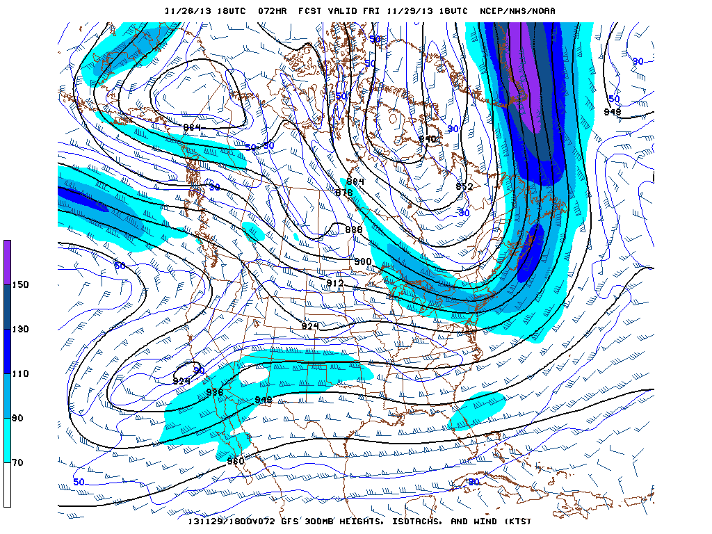 |
| 300 mb forecast noon Friday Nov. 29 2013 |
 |
| 300 mb forecast noon Dec. 3 2013
Given that much of this forecast is 5-7 days in advance, the details, particularly precipitation are uncertain. However, the turn to much colder is quite certain and there is the concern of snow, possibly substantial over a good part of the interior portions of the western states next week.
The Climate Prediction Center reflects this in their 6-10 days forecast, covering the period from Monday to Friday of next week.
 |
The Intermountain States including the Star Valley region has a high degree of confidence of above normal precipitation, in the form of snow, for the coming week.

The NWS Weather Prediction Center has attempted to show some details of the changes that are anticipated by mid day Monday.
 |
| Surface and 850 mb forecast for Noon Monday December 2.2013 |
It shows the leading edge of the cold air moving across the Star Valley area accompanied by snow, with the very cold surface high pressure moving southward through Western Canada.
This comment has been removed by a blog administrator.
ReplyDelete