Mild late Fall weather will continue through mid-week across Star Valley and the surrounding areas. However all the models now agree that a major change is coming. A strong cold front will move across western Wyoming by Thursday night ushering in the coldest temperatures since early last March.
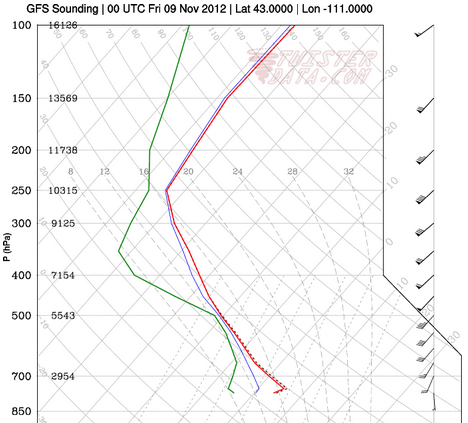
While snow is expected with and behind the cold front across the area, it is the dramatic temperature change that will have the greatest impact. Forecast model soundings for Thursday, Friday and Saturday evening over Star Valley provide a visual display of the arrival of cold air.
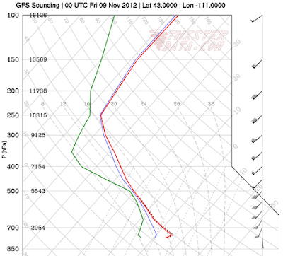 |
| Thursday Evening |
|
 | | |
| Friday Evening |
|
|
 |
| Saturday Evening |
|
|
The potential for significant snow will decrease on Saturday as colder and drier air spreads across Star Valley. Several inches of snow are possible in the valley by Saturday morning with greater amounts in the higher mountains, particularly the Tetons. At this time it does not appear to be a particularly wet storm system, but mountains could receive upwards of a foot by late Saturday.
Riverton WFO has provided a good summary of the big changes:
http://www.crh.noaa.gov/riw/?n=weatherbriefing
Star Valley temperatures will struggle to reach freezing Saturday with the potential for near zero readings in coldest locations by Sunday morning provided skies clear sufficiently.


No comments:
Post a Comment