2 NW of Etna .80
Afton .58
Smoot .49
Thayne ES .36
Alpine .32
Etna ES .30
Star Valley Ranch .22
Below is a precipitation map covering the surrounding regions from the recent storm

Over an inch occurred in the mountains north of Star Valley, particularly the Tetons.
For much of the event the snow level was above about 8500 feet.
A cam photo taken Wednesday afternoon shows the fresh snow on the Tetons.

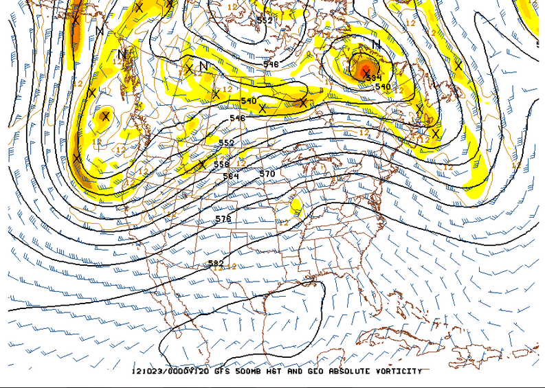
The computer models have been quite erratic in forecasting what now appears to be a major pattern change coming this weekend. However the Wednesday evening model solutions are generally agreeing that the large upper ridge now over the western states will be replaced be a strong and cold upper low pressure trough forming this weekend off the West Coast and then slowly moving eastward toward Star Valley next week.
Here is the 500 mb chart observed this Wednesday evening showing the deep low over the Central states and high pressure along the West Coast.
 | |
| 500MB Analysis Wednesday evening 10/17/12 |

However, possibly as early as Monday morning, colder air will likely lower the snow level to the valley floor. Additional periods of precipitation will likely occur well into next week with snow likely in the valley.
The following are the 24 hour forecasted precipitation amounts for Sunday and Monday.
 |
| Sunday forecasted precipitation |
 |
| 5 day total forecasted precipitation through Monday evening |
Since a big pattern change is imminent, it is instructive to put into perspective the difficulty that the current computer models have in forecasting this type of change. An excellent blog was posted this morning on this very subject and if interested can be seen here.
http://wasatchweatherweenies.blogspot.com/2012/10/rolling-dice-with-ensembles.html
No comments:
Post a Comment