The Teton–Yellowstone tornado was a rare high-altitude tornado which occurred on July 21, 1987 in the U.S. State of Wyoming. Rated at F4 on the Fujita scale, it was the strongest tornado ever recorded in the state. The tornado cut through a 24-mile (39 km) long, 1.5-mile (2.4 km) wide swath of the Teton Wilderness and Yellowstone National Park, and even crossed the Continental Divide. The damage occurred at elevations ranging from 8,500 to 10,000 feet (2,600 to 3,000 m), making it the highest altitude violent tornado recorded in the United States. No human fatalities or injuries were recorded, but up to 1,000,000 trees were uprooted by the storm. Most of the damaged forest later burned in the Yellowstone fires of 1988.
Following is an aerial photograph of some of trees that were blown down covering the Enos Lake trail.
The Google Maps image below outlines the approximate path of the Teton tornado which crossed Enos Lake.
 |
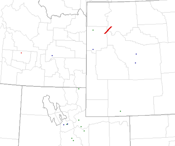
A plot of the severe reports for the day not only indicate the path of the Teton tornado but several hail reports upstream across Northern Utah.
 | |||
| Severe Thunderstorm Events July 21 1987 |
Twenty five years ago was before good radar data, including any Doppler capabilities However, the supercell that produced the Teton tornado very likely initially developed over Northern Utah where the large hail occurred and then moved rapidly under strong southwesterly flow into western Wyoming.
Here is a link to the publication by Dr. Fujita on the Teton Tornado.
http://journals.ametsoc.org/doi/abs/10.1175/1520-0493%281989%29117%3C1913%3ATTYTOJ%3E2.0.CO%3B2
The actual aerial survey was conducted by Brian Smith currently the Warning Coordination Meteorologist at the Omaha Weather Forecast Office.

Very interesting article. As far as I know from what I have read, almost all significant tornadoes in the Intermountain West have occurred in July and August. This makes sense to me, because monsoon moisture flowing up from the south can interact with an incoming cold front or dry line, a bit similar to what happens in the Plains region in spring.
ReplyDelete