 | |
In fact warm Octobers have been the rule world wide for much of the past 30 years!
 | ||||
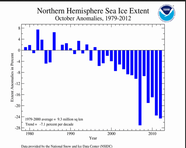
The first graph shows the loss of sea ice over the north polar areas in recent years as measured in October.
On the other hand the south polar sea ice has actually shown some increase in recent years

Comparing the daily high/low temperatures with normal and record readings for Jackson WY in October 2012 there were no record setting periods. There was a particularly cold period actually in the first part of October and then ending up well above normal


It now appears after a quick moving system drops a couple inches of snow on Sunday, the remainder of November should be dry and seasonably mild. The CPC forecast for the coming weekend suggest the mild conditions should extend into the first of December.

Much of the country should experience above normal temperatures through the weekend!
Additionally a moist air mass will spread inland on the West Coast in advance of a major Pacific low pressure trough bringing above normal precipitation into Northern/Central California and Oregon.
 | ||
The extended model precipitation forecast covering the period from midnight Wednesday through midnight Sunday shows the potential for a major heavy rain event over Northern California.

No comments:
Post a Comment